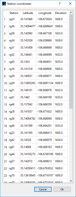
Station coordinates are populated when a data file is read. Station coordinates may be viewed or updated using the Show station coordinates... command on the Edit menu. The table shown in the popup can be copied and pasted. For example, the table could be copied to Excel, updated with post-processed GPS coordinates, and pasted back into GSadjust.